Call Us
8:00am - 17:00PM
Okavango Delta Map
Okavango Delta
Map
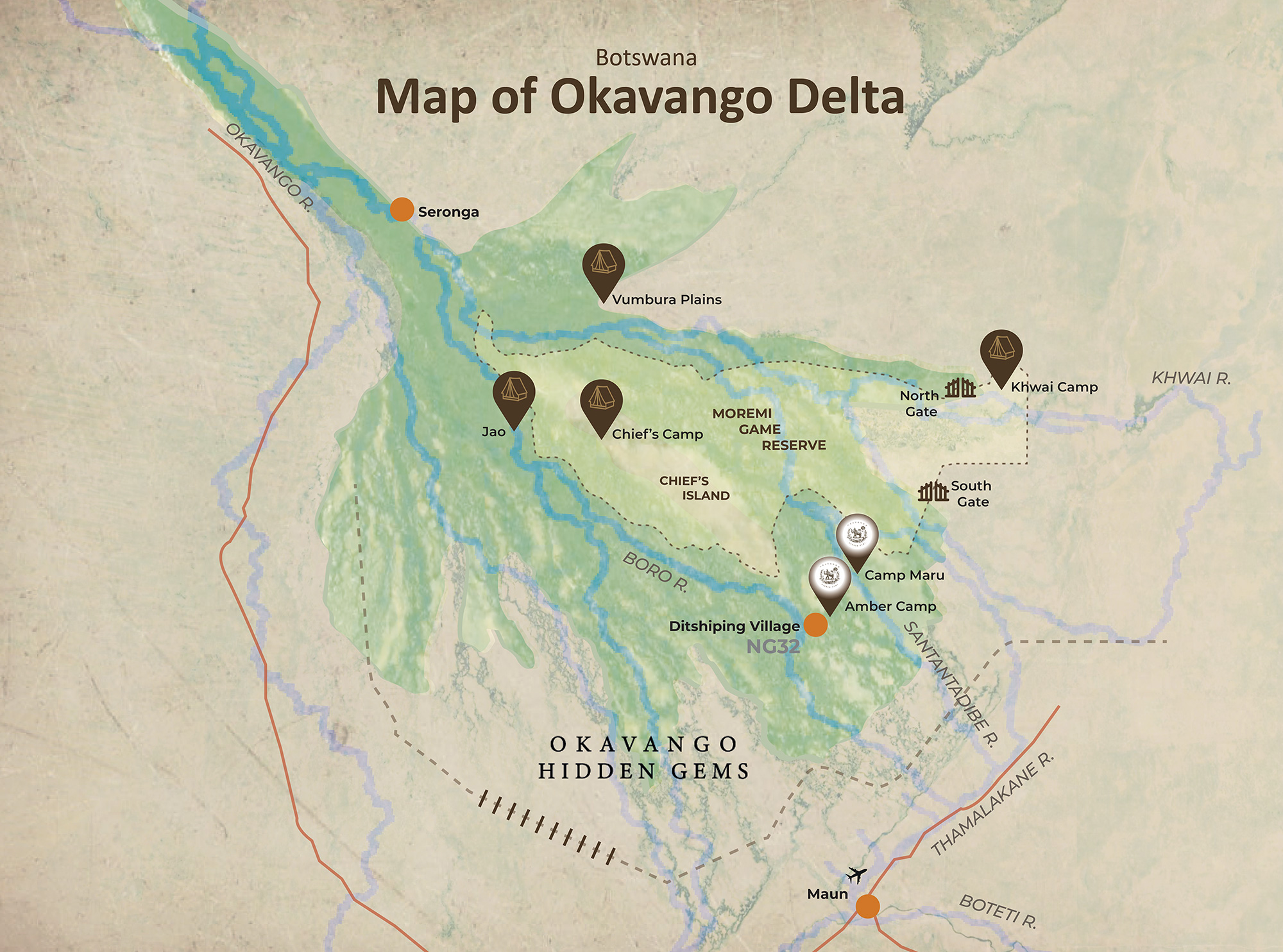
If you want a definitive way to experience the wondrous Okavango Delta at its finest, then our Okavango Delta is here to assist! It showcases all the brilliant seasonal elements and how they connect to the on-map details of the delta.
That’s not all though, the Okavango Delta Map also offers some useful background information about the delta’s topography and geographical aspects. This useful tool will help you enhance your Botswana Safari to Okavango Delta and completely immerse yourself in its surrounding attractions.
Background Information On Okavango
Before we venture into detail about the attractions of the Okavango Delta Safari, let’s look at some useful background information concerning the different map aspects of Okavango.
Location and Size
The Okavango Delta is located in the northwestern part of Botswana and covers around 600,000 hectares along with 1.2m hectares of seasonally flooded grasslands.
Topography and Landscapes
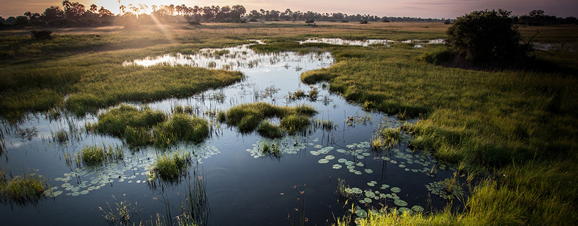
Besides the permanent channels, Okavango Delta is covered by shallow water, backwater swamps, ox-bow lakes, flooded grasslands, and hidden lagoons and is mostly interconnected by narrow waterways.
- Latitude: -19.318701
- Longitude: 22.446918
- Elevation: 930m – 1,000m
- Barometric Pressure – 1010 hPa
- Coordinates – 19.6510° S, 22.9059° E
- Nearest City – Maun
Okavango Delta’s Area
When you take a closer look at the Okavango Delta Map, you’ll come to find that the area is dominated by lagoons, salt islands, and the Chief’s Island. Here are their on-map features:
Lagoons - The rich lifeblood of the delta
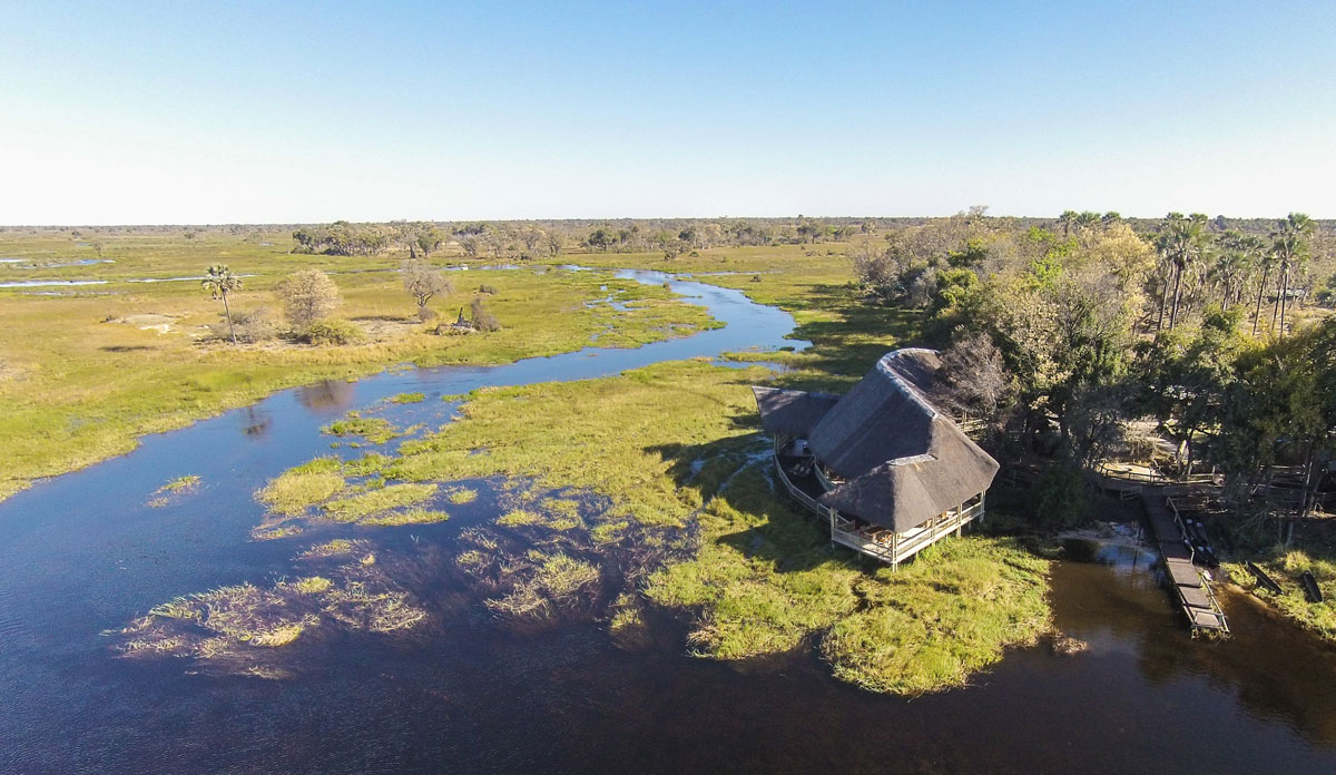
These areas are formed when the levels of water in the delta recede and the water remains in river beds, major canals, and watering holes, which attract numerous animals. Several accommodations are located around these lagoons and most photographic safaris and birdwatching happen here too. Some major lagoons and their coordinates are described below:
- Dombo Hippo Pool (19°12′1.8″S 23°38′25.8″E)
- Gcodikwe Lagoon (19°9′54″S 23°14′24″E)
- Guma Lagoon (18°57′52.2″S 22°22′40.8″E)
- Shinde Lagoon (19°6′18″S 23°9′14.4″E)
- Xakanaxa Lagoon (19°10′48″S 23°23′42″E)
- Xhamu Lagoon (19°10′1.2″S 23°16′15.6″E)
- Xhobega Lagoon (19°11′0.6″S 23°12′25.2″E)
- Xugana Lagoon (19°4′10.2″S 23°6′0″E)
- Zibadiania Lagoon (18°34′12″S 23°32′6″E)
- Jerejere Lagoon/Hippo Pool (19°5′16.8″S 23°1′12″E)
- Moanachira Lagoon/Sausage Island (19°3′23.4″S 23°3′44.3″E)
- Moanachira Lagoon (19°3′45″S 23°5′24″E)
The Salt Islands
Most of the delta is covered in different varieties of salt islands and pans that have become too salty to support the varied flora of the region, besides the salt-resistant palm trees.
Chief’s Island
Chief’s Island is situated right in the central region of the delta and is one of its largest islands. It receives flood waters every year and has a wide diversity of fertile plains and rich vegetation.
Closest Landmarks and Airports
The Okavango Delta is surrounded by the sands of the Kalahari Desert as well, and seasonal rains from the highlands of Angola supply the delta every year. Situated along the Thamalakane River, the city of Maun serves as the gateway to Okavango.
As you can see on the map, the nearest airport to the delta is Maun Airport (MUB) which is located in northern Botswana.
Okavango Delta Landmarks And Airports
The Okavango Delta is surrounded by the sands of the Kalahari Desert as well, and seasonal rains from the highlands of Angola supply the delta every year. Situated along the Thamalakane River, the city of Maun serves as the gateway to Okavango.
As you can see on the map, the nearest airport to the delta is Maun Airport (MUB) which is located in northern Botswana.
Our Convenient Okavango Delta Map
With the help of our handy Okavango Delta Map, you’ll be able to uncover all the wonders of the delta and get an overall inkling about the area’s terrains, landscapes, and topography.
Related Okavango Delta Travel Guide
We Think You’ll Love
Frequently Asked Questions
We Think You’ll Love
The Okavango Delta Map is a detailed representation of the Okavango Delta, a unique ecosystem located in Botswana. It shows the different channels, lagoons, and islands that make up the delta, as well as the various wildlife reserves and accommodations in the area.
The best way to use the Okavango Delta Map is to plan your trip to the area. It can help you identify the different Okavango Delta Accommodations and wildlife reserves in the area, as well as the best routes to take when exploring the delta. You can also use it to identify the best areas for wildlife viewing and to plan your safari activities.
Yes, there are different versions of the Okavango Delta Map, including physical maps and digital maps. Some maps may also include additional information, such as recommended accommodations, wildlife viewing areas, and hiking trails.
Yes, many versions of the Okavango Delta Map are available for download online. You can also find digital maps through travel agencies and tour operators that specialize in the region.
While it's not strictly necessary to have a map when visiting the Okavango Delta, it can be incredibly helpful when exploring the area. The delta is a vast and complex ecosystem, and having a map can help you navigate it more easily and make the most of your time there. Additionally, having a map can help you stay safe and avoid getting lost in the wilderness.
We are thrilled to help you plan your perfect safari holiday
We'd be delighted to help you with any questions you have about properties & safaris. Please fill in the form below so that we can help you create your perfect safari holiday.
Or
Contact Us
Feel free to give us a call or send us an e-mail:
Start Planning Your Tailored African Safari

Expert Safari Knowledge
With decades of expertise, we're your trusted safari guides, ensuring every moment exceeds your expectations.

Tailor-made African Safaris
Tailored to your preferences, our African Safaris guarantee an adventure perfectly suited to your desires.

Long-term Relationships
Our enduring partnerships across Africa provide exclusive access and authentic experiences.

Carefree Travel
Leave your worries behind and accept carefree travel with Falcon Safaris, where every detail is handled to perfection.
Our Travelers Say

We travelled with Falcon Safaris in Zimbabwe and Botswana for 16 days. Falcon designed a wonderful trip with private guide to the most interesting sites in both countries. The organization of the whole trip was excellent, flights within the country, accommodation and activites. The guides were very knowledgable and told us a lot about the countries, their history, people, economy and much more. We visited the Great Zimbabwe Ruins, the Victoria Falls Tour and a number of national parks in both countries.
Rhino tracking was a real adventure! We had tremendous further game drives and saw very many animals - we did the Big Five. We had much more Victoria Falls Activities than planned and enjoyed very much.We strongly recommend Falcon Safaris to everyone planning a trip to Southern Africa and East Africa.
Wonderful trip to Zimbabwe and Botswana with excellent organization and very competent guides

Our Consultant Vimbai was very helpful and accommodating. We stayed at the Elephant hills hotel which was nothing short of amazing.Our activities included a helicopter flight, dinner cruise as well as a morning game drive. All the activities were absolutely amazing.
Exceptional!

We worked with Gertrude to schedule and organize everything and she did an excellent job. I asked a lot of questions via e-mail and she answered everyone in a timely helpful manner. Our guide at Victoria Falls was also great. He met us at the airport, provided a thoughtful tour of the Falls and got us to our next guide in Botswana. Our lodgings at River View Lodge were just as described- very comfortable and excellent food. All the staff were so pleasant and helpful. If I had to do it again I would arrange a morning boat ride as well. We only did the sunset boat rides and they were the high point of our entire trip- we saw so many animals and our guide was very knowledgeable. Just a great experience. Our lodgings at Oddball's Enclave was rustic and we loved it. So great to disconnect from the world for a bit. Leo, our guide, was the best - got us out and about, saw fantastic wildlife and got back to camp safely each time. Doc manages the camp so well. This whole trip was planned and organized by Falcon Safaris and we could not have been happier.
Fabulous, well planned trip

Falcon safaris have given my the correct advice with excellent service. The only suggestion will be to work closer with the lodges to confirm bookings as soon as possible. We have booked and pay our deposit a year in advance. We have only receive our final convermation from Chobe Safari lodge a week before departure. I do realize its not within your controle but with limit alternatives and a group of 14 people it becomes an issue to find alternative accomodation if the booking was cancelled.
Excellent and efficient service
Explore Our Africa With Customize Your Tour
We love Africa's diversity and create amazing trips for you. With 30+ years of experience, we customize every trip just for you.
